The thing that makes the Jungfrau region amazing, but also difficult to navigate, is it’s location right in the heart the Bernese Alps. Towns and destinations are scattered around peaks and valleys, connected by a seemingly endless web of hiking trails and more public transit options than you even knew existed.
If you’re planning a trip to Jungfrau, there’s a good chance you have asked yourself “How do I get from [town] to [town]?” And if you’re anything like me, you might follow that question up with, “Can I hike there?” This guide will answer all of those questions and make planning your transportation a breeze.
In this Guide
This guide is meant to be simple, but it is also quite thorough. In the spirit of not overwhelming you, here’s a look at what we’re covering. You can jump around based on what you need.
- Intro to Jungfrau – Learn about the layout of the region.
- Meet the Towns – Review a list of the towns and destinations covered in this post, with a quick summary of what you’ll find there.
- Visual Guide – This table (and downloadable PDF) shows how to get between all of the villages in Jungfrau. One page displays the transit options (including connections & transit times) and the other shows hiking difficulty and elevation.
- How to get around Jungfrau from … Grindelwald, Lauterbrunnen, Wengen, Mürren, and Interlaken. If you know where you’re starting from, this is an easy way to see how to get everywhere else in one quick glance.
- Mini Grindelwald Transit Guide – This particular town is tricky because it has multiple stations and terminals that are pretty spread out. I made a map for reference.
Read more! If you like this simple, visual transit guide, you will love our Jungfrau Itinerary: Perfect Summer Trip with Kids. It is a complete Jungfrau itinerary with transit directions and hiking details all baked into an easy-to-follow PDF, which you can download and print for free.
An Intro to the Jungfrau Region
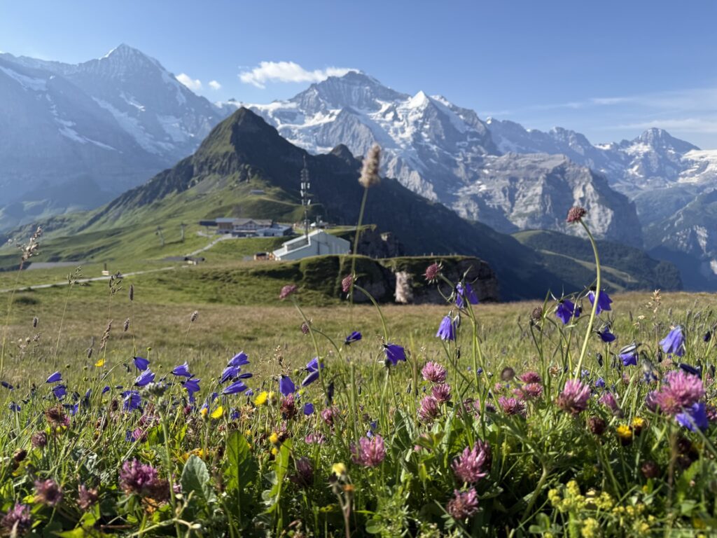
The Jungfrau Region is located in the Bernese Oberland, just south of Interlaken in southwestern Switzerland. It is very popular with tourists and locals alike, who flock to the region for hiking in the summer and skiing in the winter.
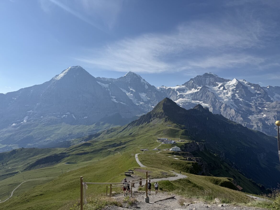
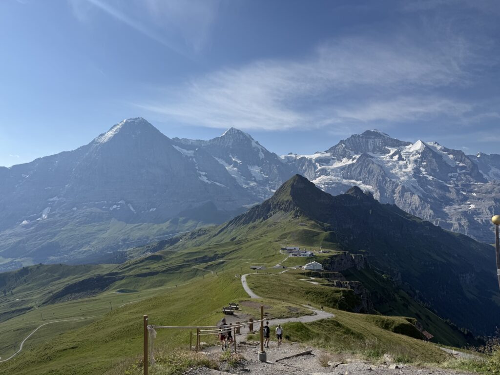
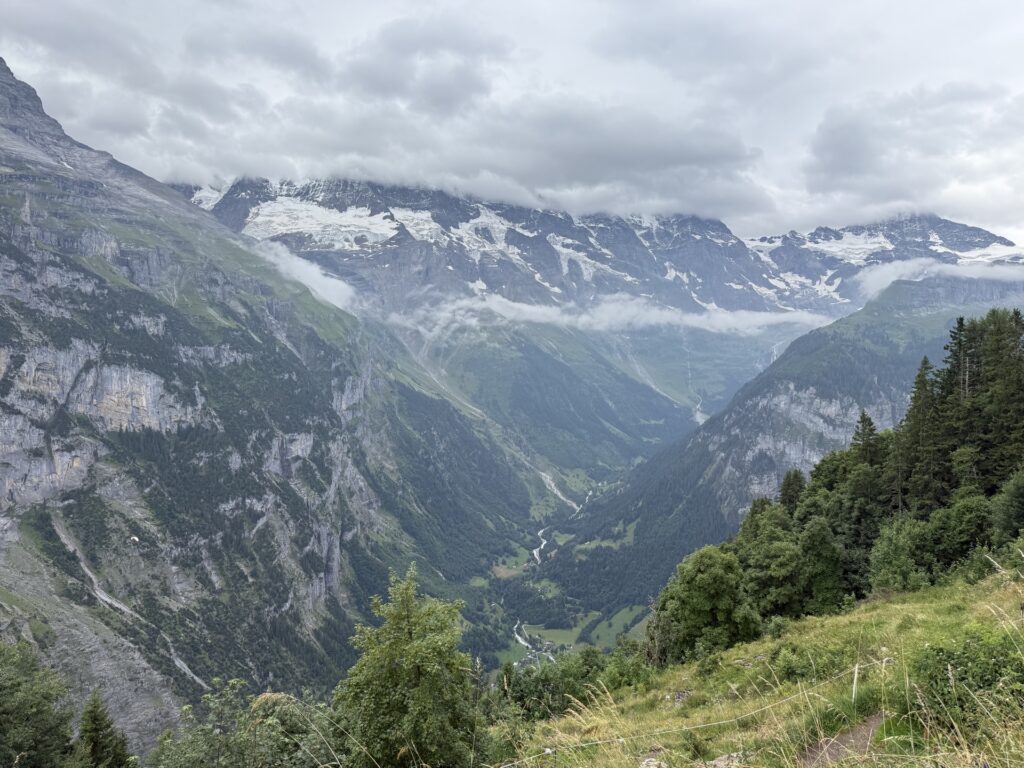
The term Jungfrau comes from the name of a specific peak by the same name. Along with Eiger and Mönch, these three peaks dominate the skyline in this part of Switzerland. In addition to the peaks, the region includes the main valleys of Grindelwald and Lauterbrunnen.
Within those valleys and peaks are several different towns and what I’ll call destinations. There are many “destinations” in this guide that aren’t quite towns, but they’re small hubs with a transit station, restaurant, and sometimes a guesthouse or playground.
These peaks and valleys are what make Jungfrau beautiful, but they’re also what make it so hard to navigate. In many cases, you can’t simply rely on Google Maps. Two points might like super close together on the map, but they’re actually separated by a vertical cliff.
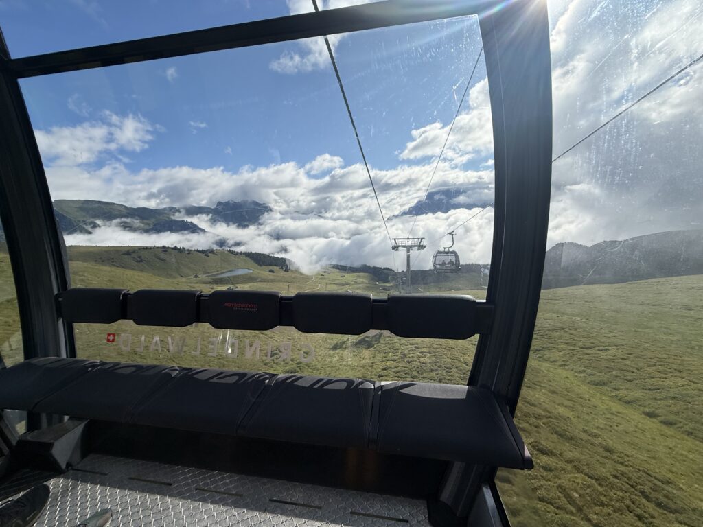
One final point of complexity is the public transportation. The transit options in Jungfrau are robust, and I love that. The area is dense with cable cars, funicular, and oh-so-many different types of trains. Everything is well connected, but it does often require multiple transfers and transit types. It’s a little overwhelming at first, but it is impressively efficiently.
NOTE: You can buy point-to-point tickets for public transportation at most stations or in the SBB app. You can also purchase a Jungfrau Travel Pass, which includes unlimited transportation on most of the regions public transit — but not all. All routes mentioned in this post are included in this pass unless specifically noted.
I put together this guide to help people understand the layout of this region and how to use public transportation to get everywhere they need to be. And since this is a hiking region, I also highlight which connections are worth hiking and which ones aren’t.
Meet the Towns of Jungfrau
For the sake of this guide, I’m focusing on towns/cities/station stops that are listed in the main tourism material and maps of this area. Specifically, I’m prioritizing the destinations that are connected by multiple transit options and have popular attractions or hiking trails.
These are the main towns and destinations that I’m covering.
Main Hubs
There a few tourist hubs in the region. These are the towns where most visitors are staying as they have the most accommodations, restaurants and shops. They’re also the main transportation stations, so they are very convenient locations.
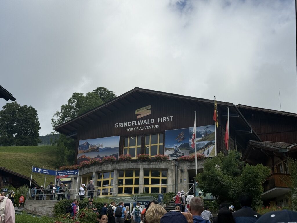
- Grindelwald is located in a valley on the east edge of the region. It is one of the larger, and most popular towns in the area. It is the gateway to the adventure activities on First (such as First Cliff Walk), but also has connections to multiple cable cars and trains in all directions.
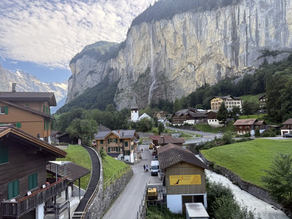
- Lauterbrunnen is also located in a valley, but is more centrally located. It’s an important transit hub, with many lines connecting here, making it a very popular place to stay. If you want fewer connections, Lauterbrunnen is a good pick.
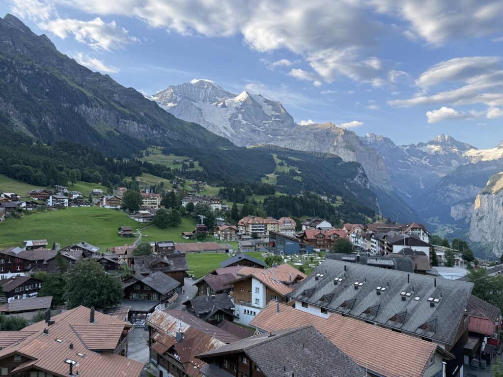
- Wengen is a car free town located higher up on the mountainside above Lauterbrunnen and below Männlichen. It’s smaller than the first two, but very charming. It’s popular with families thanks in large part to the marble runs located all over town.
- Mürren is located high on a cliff above Lauterbrunnen, opposite Wengen. It’s another car-free village. It takes a bit longer to get around the region, but it’s great if you want to focus on its nearby attractions.
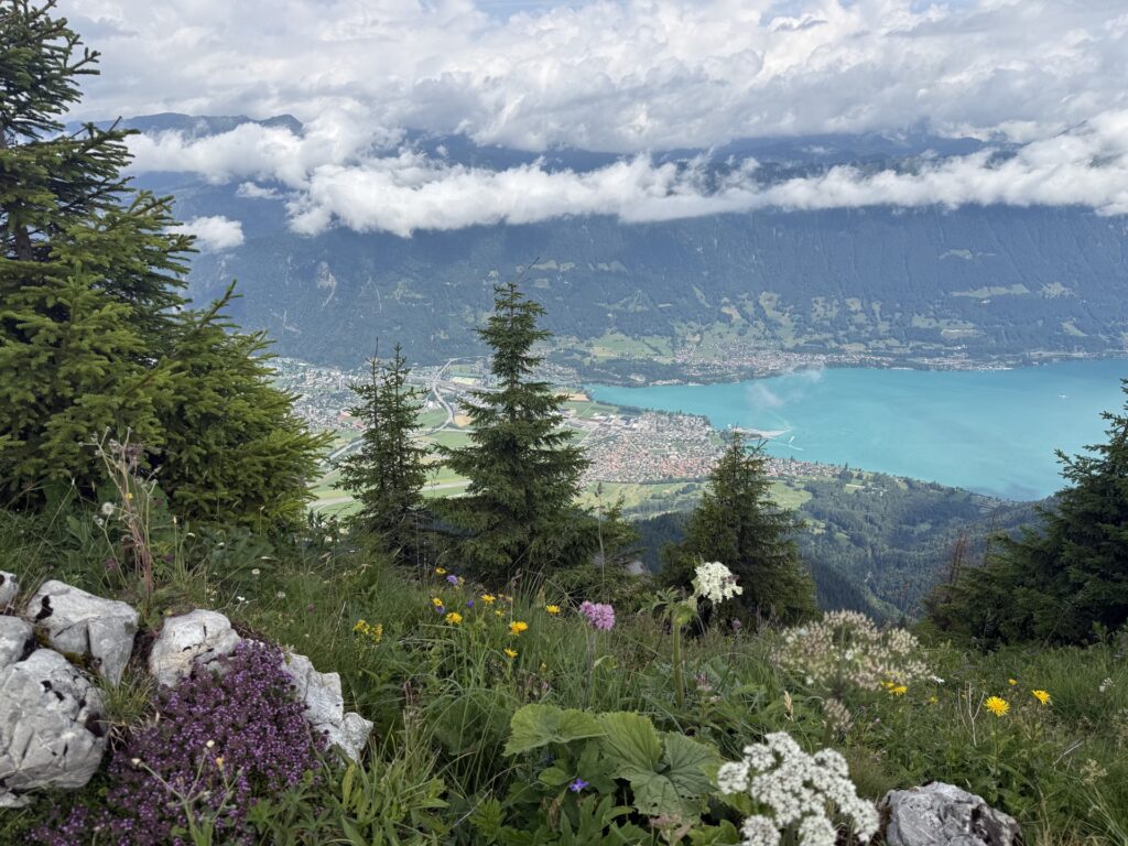
- Interlaken is the largest city in the region and also in a valley. It’s considered the “gateway to Jungfrau,” but it’s not really a part of it. It can be a good regional home base if you’re planning venture outside of Jungfrau as well.
Destinations
These are the places that are not quite towns, but are popular destinations in the area. They are important connections for hiking trails, and all have a restaurant and at least one main transportation option. They all have a variety of other amenities and attractions nearby, but you’re average tourist probably isn’t going to be staying there.
- Schynige Platte is a ridge on the west side of the region. It’s a popular destination with several hiking trails, mountaintop restaurant, playground and gift shops.
- First is the final stop on the cable car from Grindelwald to First. First Cliff Walk is the main attraction here, but there’s also a viewing deck, restaurant, gift shop. It’s also the start of the First Flyer. There are several hiking trails nearby, including the most popular one to Bachalpsee.
- Pfingstegg is on a separate cable car line, which is not included with the Jungfrau Travel Pass. The main attraction here is the mountain coaster and zip lines. There’s a few restaurants here as well.
- Männlichen is near the top of a peak, and is most popular for its views, cow themed playground and The Royal Walk, a short hike to the nearby peak. It has a restaurant and two gondola stations.
- Kleine Scheidegg is a popular hub as the end of the Panorama Trail from Mannlichen and as the start of the train up to Jungfraujoch. It has several restaurants and train connections.
- Jungfraujoch is the highest train station in Europe. There’s a slew of activities up there, including an ice palace, observation deck, sledding and much more.
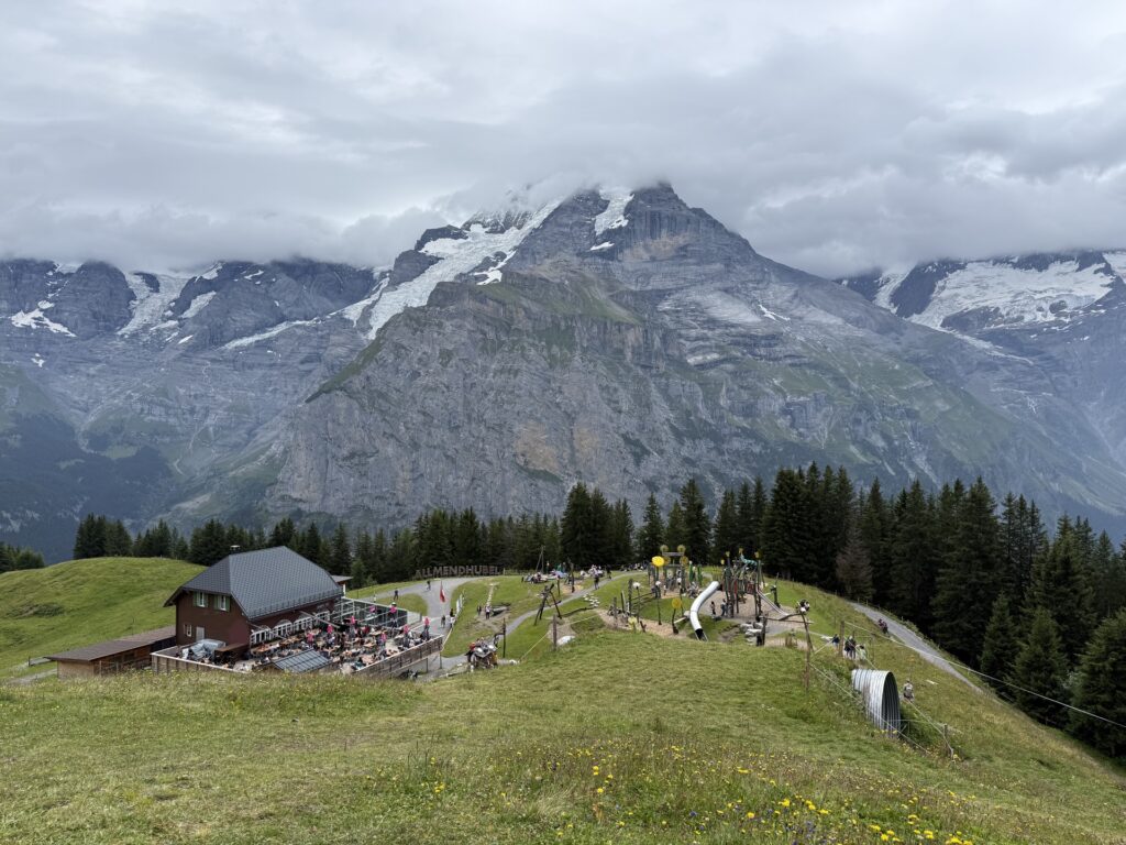
- Allmendhubel, home to the beloved Flower Playground, is located high above Mürren. It’s a popular destination for families as it has an amazing playground and restaurant.
- Piz Gloria is located above Mürren at the peak of the Schilthorn. It’s a rotating restaurant that’s also famous as a James Bond filming location.
Intermediate Stops
These are the station stops that you probably didn’t know you needed to know about. You likely won’t spend too much time at, but they are important markers on the transit map. If you are doing any hiking in the region, these connections matter a lot.
- Bort is the first stop on the cable car to First. It’s also the top station for Trottibike, which you can ride down to Grindelwald. There’s a restaurant, snack stand and playground.
- Schreckfeld is the second stop on the cable car to First. It’s the starting point for the mountain cart, which you can ride down to Bort, and it’s where you board First Glider. There’s also a restaurant.
- Holenstein has a cable car station and a playground. It is the end of a popular kids hike, Lieselotte Trail.
- Eigergletscher is the only intermediate station between Kleine Scheidegg and Jungfraujoch. It’s also the main starting point for the popular Eiger Trail hike. This little hub is only a train and cable car station.
- Alpiglen is a tiny little town at the end of the Eiger Trail. There’s a train station, playground and restaurant.
- Winteregg is a train stop on the way to Mürren. It has a nice playground, restaurant, a massive swing, and some games for adults.
- Stechelberg is located right below Mürren in the same valley as Lauterbrunnen. It’s basically just a transit stop with a small snack stand, but there’s a lovely trail that runs between here and Lauterbrunnen.
A Visual Guide to Getting Around Jungfrau
Maybe it’s because I planned my entire trip to Switerland in less than 2 weeks, but trying to figure out how to get everywhere was hard for me. There were two questions I found myself asking every time I needed to get between two places: “How long is it going to take?” and “Can I hike there.”
I found myself constantly checking the SBB app to see how to get between places, and then checking Alltrails to see if I could hike there instead. With limited time and energy (and a 5-year-old in tow), I needed to be picking the right trails to hike and the right routes to take public transit.
Once I got to Jungfrau, it all kind of clicked. I got a very quick, visual sense of the landscape and started to wrap my head around what was up and what was down — quite literally. I wanted to make a visual guide for other travel planners to jump straight to this point.
Enter the Jungfrau Visual Guide!
The visual guide is a 2-page PDF that is completely free to download. The table format allows you to you choose the town you’re starting from and the town you’re going to and quickly see how to get there (including time and transfers) and if you should hike there (including elevation change and difficulty). I’ve also indicated whether each location is in a valley or up in the mountains, which is an important factor in the Alps.
Click the “download” button below the image preview to download the printable PDF.
NOTE: My hiking gage is based on whether most casual tourists would hike it. Most of these routes are technically hike-able, but are either very long or very strenuous, so most people don’t.
2026 Mürren Service Update: The cable car from Lauterbrunnen to Mürren will not be running from April 13 through July 10 due to planned maintenance. Impacts and alternate routes have been added throughout this post.
In the rest of this post, you’ll basically find a written out version of this table. If you’re not a charts person, simply scroll down to the village you’re starting from and then review the transportation options to the rest of Jungfrau.
How to get around Jungfrau from Grindelwald
So you’re based out of Grindelwald. That’s great because there tons of connections available. However, there are multiple train and cable car stations, so be sure you go to the right one. For clarity on the different stations and locations, we put together a mini guide and map in the next section.
How to get from Grindelwald to …
Here’s a quick summary of how to get around Jungfrau from Grindelwald. For schedules and ticket information, use the SBB app.
- Grindelwald to Bort: 1 cable car
- Grindelwald to Schreckfeld: 1 cable car
- Grindelwald to First: 1 cable car
- Grindelwald to Pfingstegg: 1 cable car (This cable car is NOT included in the Jungfrau Travel Pass.)
- Grindelwald to Lauterbrunnen: 2 trains (Grindelwald to Zweilütschinen > Zweilütschinen to Lauterbrunnen)
- Grindelwald to Wengen: 3 trains (Grindelwald to Zweilütschinen > Zweilütschinen to Lauterbrunnen > Lauterbrunnen to Wengen) or 2 cable cars (Grindelwald to Männlichen > Männlichen to Wengen)
- Grindelwald to Mürren: 2 trains to Lauterbrunnen (Grindelwald to Zweilütschinen > Zweilütschinen to Lauterbrunnen) + 1 cable car to Grütschalp + 1 train (Grütschalp to Mürren) (Check 2026 Mürren Service Update below)
- Grindelwald to Interlaken: 1 train
- Grindelwald to Männlichen: 1 cable car
- Grindelwald to Holenstein: 1 cable car
- Grindelwald to Kleine Scheidegg: 1 train
- Grindelwald to Schynige Platte: 2 trains (Grindelwald to Wilderswil > Wilderswil to Schynige Platte)
- Grindelwald to Alpiglen: 1 train
- Grindelwald to Stechelberg: 2 trains to Lauterbrunnen (Grindelwald to Zweilütschinen > Zweilütschinen to Lauterbrunnen) + bus (or hike) to Stechelberg
HIKING NOTES: Because Grindelwald is in a valley, hiking most anywhere requires going up. I wouldn’t recommend hiking between Grindelwald and any of the locations listed above. However, the hike down from First to Bort was one of my favorite in Switzerland.
2026 Mürren Service Update: The cable car from Lauterbrunnen to Mürren will not be running from April 13 through July 10 due to planned maintenance. This is the alternate route during that time. 2 trains to Lauterbrunnen (Grindelwald to Zweilütschinen > Zweilütschinen to Lauterbrunnen) + 1 bus to Stechelberg + 1 cable car to Mürren (cable car not on Jungfrau travel pass)
A Mini Transit Guide to Grindelwald
The bolded terms below are how each of these locations appear in the SBB transit app.
- Grindelwald, Bahnhof (Main Train Station): This is the main station in town. Most trains coming from Interlaken, Zweilütschinen and Lauterbrunnen terminate at this station.
- Grindelwald Grund (train station): This is the station for the train toward Kleine Scheidegg.
- Grindelwald, Firstbahn (cable car station): This is the cable car station that leads up to First, with stops at Bort and Schreckfeld along the way.
- Grindelwald Terminal (cable car station): This station serves the Männlichen cable car line and the Eigergletscher cable car line. There’s also limited train service to Grindelwald Bahnhof and to Zweilütschinen.
- Grindelwald, Pfingsteggbahn (cable car station): This is the valley cable car station that exclusively goes up to the Pfingstegg attractions, including the zip line and mountain coaster. (This cable car is NOT included in the Jungfrau Travel Pass.)
If you’re coming from most places in the region, you’re probably wondering if you can walk between some of these stations.
- Can you walk from the Grindelwald train station (Bahnhof) to the First Cable Car (Firstbahn)? Yes. If you’re arriving by train to Grindelwald from Lauterbrunnen or Interlake, you’ll arrive at the main station. It’s a lovely 10 minute walk through downtown to the cable car station to first. Here is the route.
- Can you walk from Grindelwald Terminal to the First Cable Car (Firstbahn)? You could, but it’s probably not worth it. It’s about 1.5 miles and most of it is not that exciting. Instead, take the public bus. It’s included in the Jungfrau Travel Pass and the signs are pretty clearly marked.
Here’s a helpful map, too. Click on each icon for the name of the station and notes on the available connections.
How to get around Jungfrau from Lauterbrunnen
So you’re based out of Lauterbrunnen. That’s great because the central location means you’ll be well connected to the whole region. This valley is also surrounded by waterfalls, but so be sure explore some of the nearby hiking trails and waterfall attractions.
Read more! Looking for things to do nearby? Be sure to check out our guide full of Best things to do in Lauterbrunnen, Switzerland
How to get from Lauterbrunnen to …
Here’s a quick summary of how to get around Jungfrau from Lauterbrunnen. For schedules and ticket information, use the SBB app.
- Lauterbrunnen to Grindelwald: 2 trains (Lauterbrunnen to Zweilütschinen > Zweilütschinen to Grindelwald)
- Lauterbrunnen to First: 2 trains (Lauterbrunnen to Zweilütschinen > Zweilütschinen to Grindelwald) + 1 cable car
- Lauterbrunnen to Wengen: 1 train
- Lauterbrunnen to Mürren: 1 cable car to Grütschalp + 1 train (Grütschalp to Mürren) (Check 2026 Mürren Service Update below)
- Lauterbrunnen to Interlaken: 1 train
- Lauterbrunnen to Männlichen: 1 train to Wengen + 1 cable car
- Lauterbrunnen to Holenstein: 1 train to Wengen + 1 cable car
- Lauterbrunnen to Kleine Scheidegg: 1 train
- Lauterbrunnen to Schynige Platte: 2 trains (Lauterbrunnen to Wilderswil > Wilderswil to Schynige Platte)
- Lauterbrunnen to Alpiglen: 2 trains (Lauterbrunnen to Kleine Scheidegg > Kleine Scheidegg to Alpiglen)
- Lauterbrunnen to Stechelberg: 1 bus (or hike)
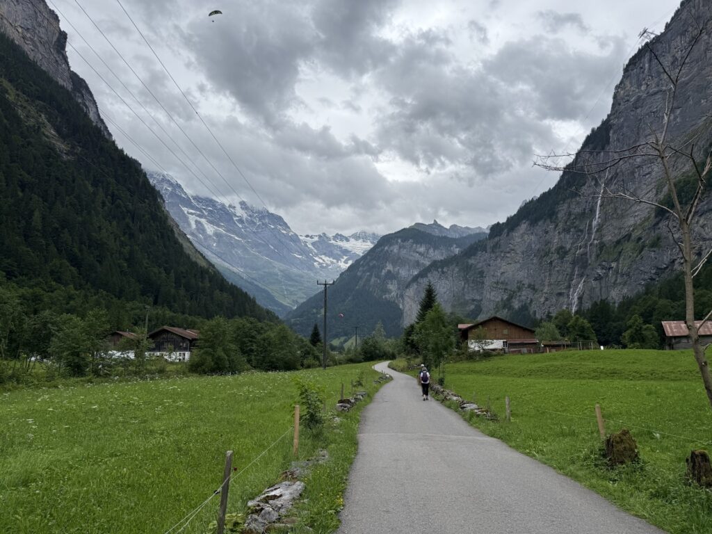
HIKING NOTES: Like Grindelwald, Lauterbrunnen is in a valley, so hiking to most of these destinations requires a steep climb. However, one of the loveliest and easiest hikes in the region is from Lauterbrunnen to Strechelberg. There’s a flat walking trail that follows along the river and showcases views of the nearby waterfalls.
2026 Mürren Service Update: The cable car from Lauterbrunnen to Mürren will not be running from April 13 through July 10 due to planned maintenance. This is the alternate route during that time. 1 bus to Stechelberg + 1 cable car to Mürren (cable car not on Jungfrau travel pass)
How to get around Jungfrau from Wengen
So you’re based out of Wengen. Are you traveling with kids? If so, you made a great choice! Enjoy marble runs all around town, a vibrant main street and some of the best views out of the main tourist towns. And most importantly, you’re just a 5 minute cable car away from the best playground in the region. (If you’re not traveling with kids, you still made a great choice! You’ll just probably spend less time at the playgrounds.)
Staying up on the mountainside in Wengen, though, does mean that you’re in for a few more transfers. Fear not. The trains here run like, well…Swiss Trains. 😉
Read more! Check out our list of Best things to do in Wengen, Switzerland
How to get from Wengen to …
Here’s a quick summary of how to get around Jungfrau from Wengen. For schedules and ticket information, use the SBB app.
- Wengen to Grindelwald: 3 trains (Wengen to Lauterbrunnen > Lauterbrunnen to Zweilütschinen > Zweilütschinen to Grindelwald) or 2 cable cars (Wengen to Männlichen > Männlichen to Grindelwald)
- Wengen to First: 3 trains to Grindelwald (Wengen to Lauterbrunnen > Lauterbrunnen to Zweilütschinen > Zweilütschinen to Grindelwald) + 1 cable car (Grindelwald > First)
- Wengen to Lauterbrunnen: 1 train
- Wengen to Mürren: 1 train to Lauterbrunnen + 1 cable car to Grütschalp + 1 train (Grütschalp to Mürren) (Check 2026 Mürren Service Update below)
- Wengen to Interlaken: 2 trains (Wengen to Lauterbrunnen > Lauterbrunnen to Interlaken Ost)
- Wengen to Männlichen: 1 cable car
- Wengen to Holenstein: 2 cable cars (Wengen to Männlichen > Männlichen to Holenstein)
- Wengen to Kleine Scheidegg: 1 train
- Wengen to Schynige Platte: 3 trains (Wengen to Lauterbrunnen > Lauterbrunnen to Wilderswil > Wilderswil to Schynige Platte)
- Wengen to Alpiglen: 2 trains (Wengen to Kleine Scheidegg > Kleine Scheidegg > Alpiglen)
- Wengen to Stechelberg: 1 train to Lauterbrunnen + 1 bus (or hike)
HIKING NOTES: Wengen is right in the middle of the mountainside, so everything is basically straight up or straight down. There’s not a lot of great hiking from here. That said, there are trails up to Männlichen and down to Lauterbrunnen, but they’re very steep.
2026 Mürren Service Update: The cable car from Lauterbrunnen to Mürren will not be running from April 13 through July 10 due to planned maintenance. This is the alternate route during that time. 1 train to Lauterbrunnen + 1 bus to Stechelberg + 1 cable car to Mürren (cable car not on Jungfrau travel pass)
How to get around Jungfrau from Mürren
So you’re based out of Mürren. That’s great because you will be spoiled with Swiss charm and solitude from this mountaintop village. That solitude does come with a tax, though. There are a few destinations right in your background, but getting around to the other towns nearby may feel clunky. If you’re planning to explore Jungfrau from Mürren, you’ll definitely want to familiarize yourself with the transit options below before you commit.
How to get from Mürren to …
Here’s a quick summary of how to get around Jungfrau from Mürren. For schedules and ticket information, use the SBB app.
**2026 Service Notice: The cable car between Lauterbrunnen and Mürren will not be running from April 13 through July 10 due to planned maintenance. To get from Mürren to Lauterbrunnen, take the cable car from Mürren to Stechelberg (not on Jungfrau travel pass) and then take the bus or hike to Lauterbrunnen.
- Mürren to Winteregg: 1 train or hike*
- Mürren to Grütschalp: 1 train or hike*
- Mürren to Allmendhubel (Flower Playground): 1 funicular (not included in Jungfrau Travel Pass) OR hike**
- Mürren to Piz Gloria (Schilthorn): 1 cable car (not included in Jungfrau Travel Pass) or hike**
- Mürren to Grindelwald: 1 train to Grütschalp + 1 cable car to Lauterbrunnen + 2 trains (Lauterbrunnen to Zweilütschinen > Zweilütschinen to Grindelwald)
- Mürren to First: 1 train to Grütschalp + 1 cable car to Lauterbrunnen + 2 trains (Lauterbrunnen to Zweilütschinen > Zweilütschinen to Grindelwald) + 1 cable car
- Mürren to Lauterbrunnen: 1 train to Grütschalp + 1 cable car
- Mürren to Wengen: 1 train to Grütschalp + 1 cable car to Lauterbrunnen + 1 train (Lauterbrunnen to Wengen)
- Mürren to Interlaken: 1 train to Grütschalp + 1 cable car to Lauterbrunnen + 1 train (Lauterbrunnen to Interlaken)
- Mürren to Männlichen: 1 train to Grütschalp + 1 cable car to Lauterbrunnen + 1 train to Wengen + 1 cable car
- Mürren to Holenstein: 1 train to Grütschalp + 1 cable car to Lauterbrunnen + 1 train to Wengen + 2 cable cars (Wengen to Männlichen > Männlichen to Holenstein) or 1 train to Grütschalp + 1 cable car to Lauterbrunnen + 2 trains to Grindelwald (Lauterbrunnen to Zweilütschinen > Zweilütschinen to Grindelwald) + 1 cable car
- Mürren to Kleine Scheidegg: 1 train to Grütschalp + 1 cable car to Lauterbrunnen + 1 train
- Mürren to Schynige Platte: 1 train to Grütschalp + 1 cable car to Lauterbrunnen + 2 trains (Lauterbrunnen to Wilderswil > Wilderswil to Schynige Platte)
- Mürren to Alpiglen: 1 train to Grütschalp + 1 cable car to Lauterbrunnen + 3 trains (Lauterbrunnen to Zweilütschinen > Zweilütschinen to Grindelwald > Grindelwald to Alpiglen)
- Mürren to Stechelberg: 1 cable car (This cable car is NOT included in the Jungfrau Travel Pass.)
HIKING NOTES: Despite it’s cliffside location, there are a few notable hikes from here. Here are a few popular options, which are referenced above.
*Hike from Mürren to Grütschalp, via Winteregg. This hike, called the Detective Trail, is a family-friendly themed trail. There are 16 puzzles along the ~3-mile, flat trail, which make it fun for little ones. It’s about 40 minutes from Mürren to Winteregg and 50 minutes from Winteregg to Grütschalp.
**Hike from Mürren to Allmendhubel. I won’t bury the lead: this hike is pretty hard. It’s short, but basically straight up. The funicular isn’t included in the Jungfrau Travel Pass, so I tried to save money and walk instead. It’s possible — my almost-5-year-old did it — but I wouldn’t recommend it.
***Hike from Mürren to Piz Gloria. This is a challenging hike, but looks incredible. I wanted to do this hike so bad. Ultimately, we decided it against it because we already pushed our child on a fair number of challenging hikes. If you’re interested though, check out this post.
How to get around Jungfrau from Interlaken
So you’re based out of Interlaken. That’s great because you’ve got two stunning lakes, a in the largest city in the area, you have access to a huge range of restaurants and accommodations to choose from. Plus, you’ll enjoy easy to easy transfers to Jungfrau and to Switzerland beyond.
How to get from Interlaken to …
Here’s a quick summary of how to get around Jungfrau from Interlaken. For schedules and ticket information, use the SBB app.
- Interlaken to Harder Kulm: 1 funicular
- Interlaken to Grindelwald: 1 train
- Interlaken to First: 1 train + 1 cable car
- Interlaken to Mürren: 1 train to Lauterbrunnen + 1 cable car to Grütschalp + 1 train (Check 2026 Mürren Service Update below)
- Interlaken to Lauterbrunnen: 1 train
- Interlaken to Wengen: 2 trains (Interlaken to Lauterbrunnen > Lauterbrunnen to Wengen)
- Interlaken to Männlichen: 2 trains (Interlaken to Lauterbrunnen > Lauterbrunnen to Wengen) + 1 cable car
- Interlaken to Holenstein: 1 train to Grindelwald + 1 cable car
- Interlaken to Kleine Scheidegg: 2 trains (Interlaken to Grindelwald > Grindelwald to Kleine Scheidegg)
- Interlaken to Schynige Platte: 2 trains (Interlaken to Wilderswil > Wilderswil Schynige Platte)
- Interlaken to Alpiglen: 2 trains (Interlaken to Grindewald > Grindelwald to Alpiglen)
- Interlaken to Stechelberg: 1 train to Lauterbrunnen + bus (or hike)
2026 Mürren Service Update: The cable car from Lauterbrunnen to Mürren will not be running from April 13 through July 10 due to planned maintenance. This is the alternate route during that time. 1 train to Lauterbrunnen + 1 bus to Stechelberg + 1 cable car to Mürren (cable car not on Jungfrau travel pass)
Leave a Reply